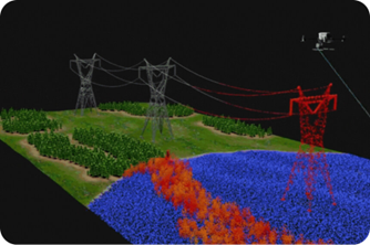
HIGH PRECISION DRONE DATA. ACTIONABLE JOBSITE INTELLIGENCE.
Transform your jobsite with SITECH Wyoming and Propeller. Capture high-accuracy data in minutes and empower your entire team to track progress, manage volumes, and stay on design.
THE ADVANTAGE
Traditional surveying is slow and keeps your team in harm’s way. By combining Propeller’s industry-leading cloud platform with SITECH’s local expertise and Trimble-integrated hardware, we provide a “single-source of truth” for your entire project. Reduce rework, eliminate disputes, and know exactly where your dirt is moving.
ESTABLISH ACCURATE EXISTING GROUND
Before the first shovel hits the dirt, get a perfect digital twin of your site. We help you establish highly accurate baseline topographies in hours, not days, ensuring your estimates are based on reality, not guesswork.
VISUAL PROGRESS TRACKING
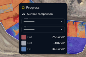
Stop wondering if you’re on schedule. Use 3D heatmaps and “Timeline” views to see exactly how your site changes flight-over-flight. Compare today’s terrain against yesterdays to identify bottlenecks before they impact your margin.
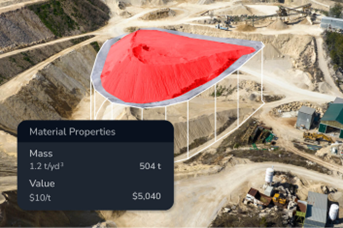
INVENTORY AND VOLUME MANAGEMENT
Manage your stockpiles with 1-3% accuracy from the safety of the office. Quickly calculate volumes, material density, and dollar value across your entire site. No more climbing piles or manual clicking – just instant, repeatable results.
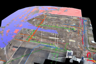
DESIGN AND CONFORMANCE AND AS-BUILDS
Upload your CAD designs (linework and surfaces) directly into the platform. Instantly see how your site compares to the final design. Verify as-builds in real-time to ensure every lift is to spec, reducing the risk of costly end-of-project corrections.
SEAMLESS FIELD COLLABORATION
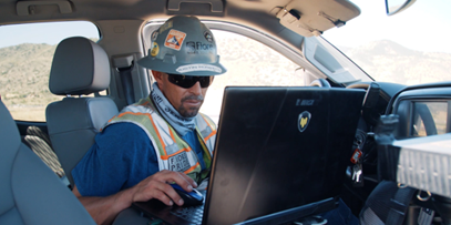
Propeller is mobile-enabled, meaning your data isn’t trapped on one computer. Share maps with project managers, foreman, and stakeholders. Whether in the office or the field, everyone has access to the same measurements, photos, and site maps.
TRIMBLE ACCURACY MEETS CLOUD CONVENIENCE
SITECH Wyoming ensures your drone data is “survey-grade” by utilizing Propeller AeroPoints – the world’s first “smart” ground control points.
Fully Integrated: Works seamlessly with Trimble Business Center and WorksManager.
Local Support: SITECH Wyoming provides the training and technical support to ensure your flights are successful from day one.